Coromandel’s CFM spoke with Dennis Tegg this morning in a lengthy interview related to our story yesterday about the potential for the closure of areas around The Coromandel to commercial and recreation fishing.
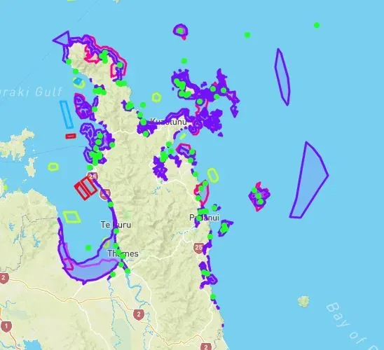
Dennis Tegg has clarified a number of areas and in particular the map below which was copied from the Council’s website. The map according to Mr Tegg shows areas of indigenous biodiversity or areas where threatened species or breeding takes place. They are areas of interest and do not reflect areas planned for closure according to Mr Tegg.
He said that the map shows these areas and there is no plans at this time to close these for fishing. For this to happen there will be a lot more work needed to provide the research to establish the justification for this closure and this work has not yet been undertaken.
The next step in this process is the completion of a detailed plan and the consultation with statutory groups including IWI before seeking formal public submissions. He said this process is not going to be completed for sometime and it will be years away from a final resolution and will not be implemented before everyone is given an opportunity for formal input to the process. It would require RMA consent as well.
Mr Tegg acknowledged that he could see the confusion from the map and the document released entitled Marine Biodiversity Protection Areas. CFM has asked for a Council spokesperson to talk to this and we will have them on air as soon as possible.